Tree Density Map
The Assignment
The aim of this assignment is to learn about vector data processing operations through investigating tree density in Utrecht neighborhoods. Exploring tree density can inform decision-making by answering the following questions: where should more trees be planted and why? Where should we create a park or protected are to protect more trees? Which subdistrict has the highest tree density?. In this way, cities can also evaluate problems related to reaching SDG 15: Life on land.
Data Collection
"Bomenkaart" feature layer owned by Utrech Geo
"Gemeenten provincie Utrecht" feature layer owned by Province Utrecht
"Grenzen Utrecht" WFS owned by Utrecht Geo
The Process
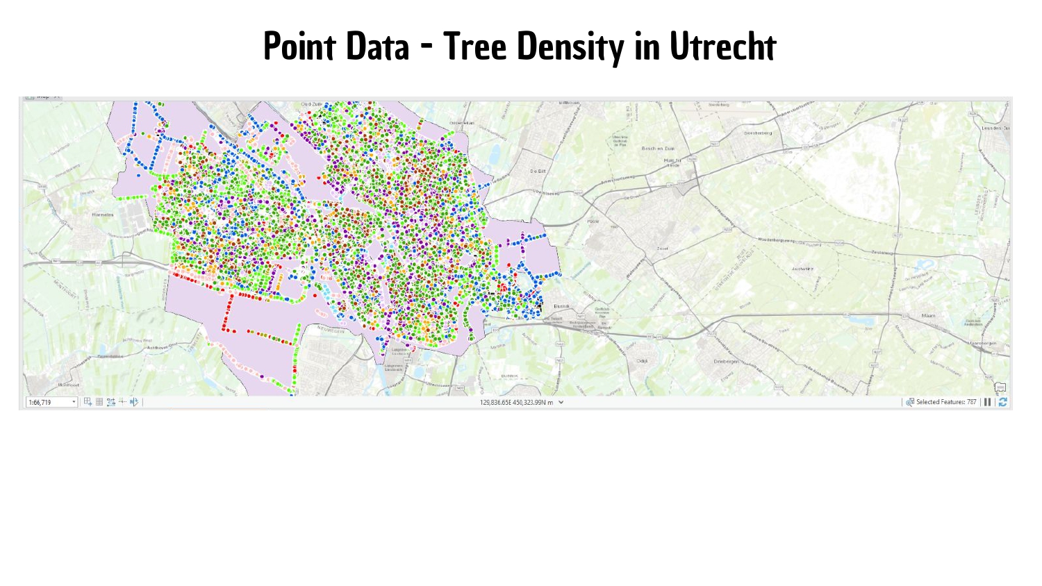
1. Selected the "Bomenkaart" feature layer for tree point data.
2. Selected the "Gemeenten provincie Utrecht" feature layer for the division of Utrecht into municipalities.
3. Selected the "Grenzen Utrecht" feature layer.
4. Set the locational units, area units and distance units to meters to ensure consistency and accuracy in the calculations.
5. Used the SummarizeWithin analysis tool to aggregate tree data within each municipality
6. Calculated the rate area by dividing the point count of trees by the area size, to normalize the data and allow for a meaningful comparison of tree density.
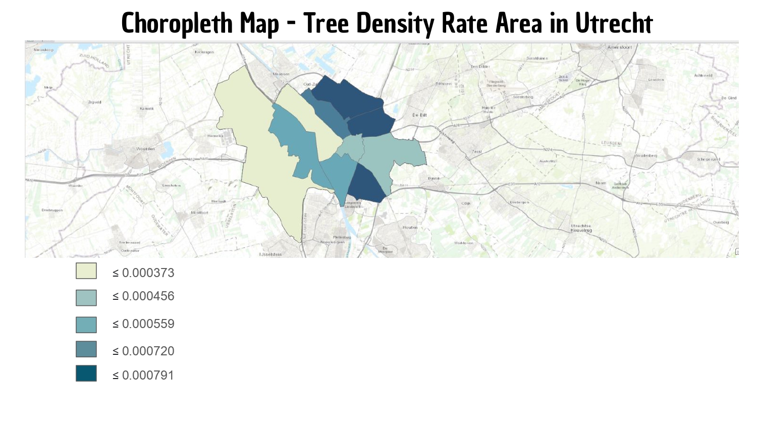
7. Create a choropleth map from the rate area.
What can be seen
The point data shows that Vleuten is the neighborhood with the most trees (36 343). However, it is also the largest. Converting the data into a choropleth map based on the rate area allows for a proportional analysis. When the size of the neighborhood is also taken into account, Vleuten has the least amount of trees proportionally (as seen by its light beige color).
In terms of tree count, Zuidwest, Binnenstad and Noordoost have the least trees. This can inform local policy-makers to prioritize these areas when creating new parks or green areas.
Feedback
From students and instructor