Carbon Sequestration in Santiago Metropolitan Region, Chile
The Assignment
The aim of this assignment is to create an interactive map using Google Earth Engine (GEE) to visualize carbon sequestration and high carbon density areas to better inform carbon offset efforts. For this, two laters were created: gross primary production (GPP) and aboveground carbon density (ACD). GPP is defined as the total amount of carbon dioxide converted into glucose via photosynthesis (in an ecosystem, over a specific period of time) and represents the total rate of photosynthesis, allowing for the assessment of an area’s potential to uptake and store carbon. The area may then be managed to offset carbon emissions elsewhere. Additionally, ACD represents the amount of carbon stored in the living biomass of vegetation above the soil. Areas with a high ACD will thus usually be prime targets for conservation and carbon offset efforts. Combining both variables allows policymakers to prioritize areas that will result in the most effective carbon offset results.
Data Collection
Above-Ground biomass data from SMR was obtained using the ESA biomass dataset for 2020.
The Process
1. Identified Region of Interest (ROI) as SMR using geojson.io and converted it to a zipped SHP file.
2. Calculated the area using SHP area calculator script.
3. Located and downloaded the appropriate ESA biomass Geotiff file for the region of interest.
4. Incorporated it into the CSPI GEE code.
5. Applied ROI to the CSPI code by updating the feature collection and replacing the default ROI.
6. Ran the GEE script.
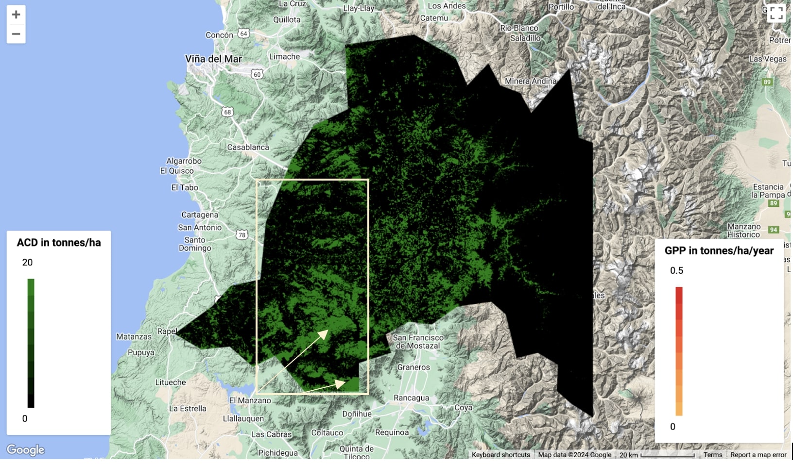
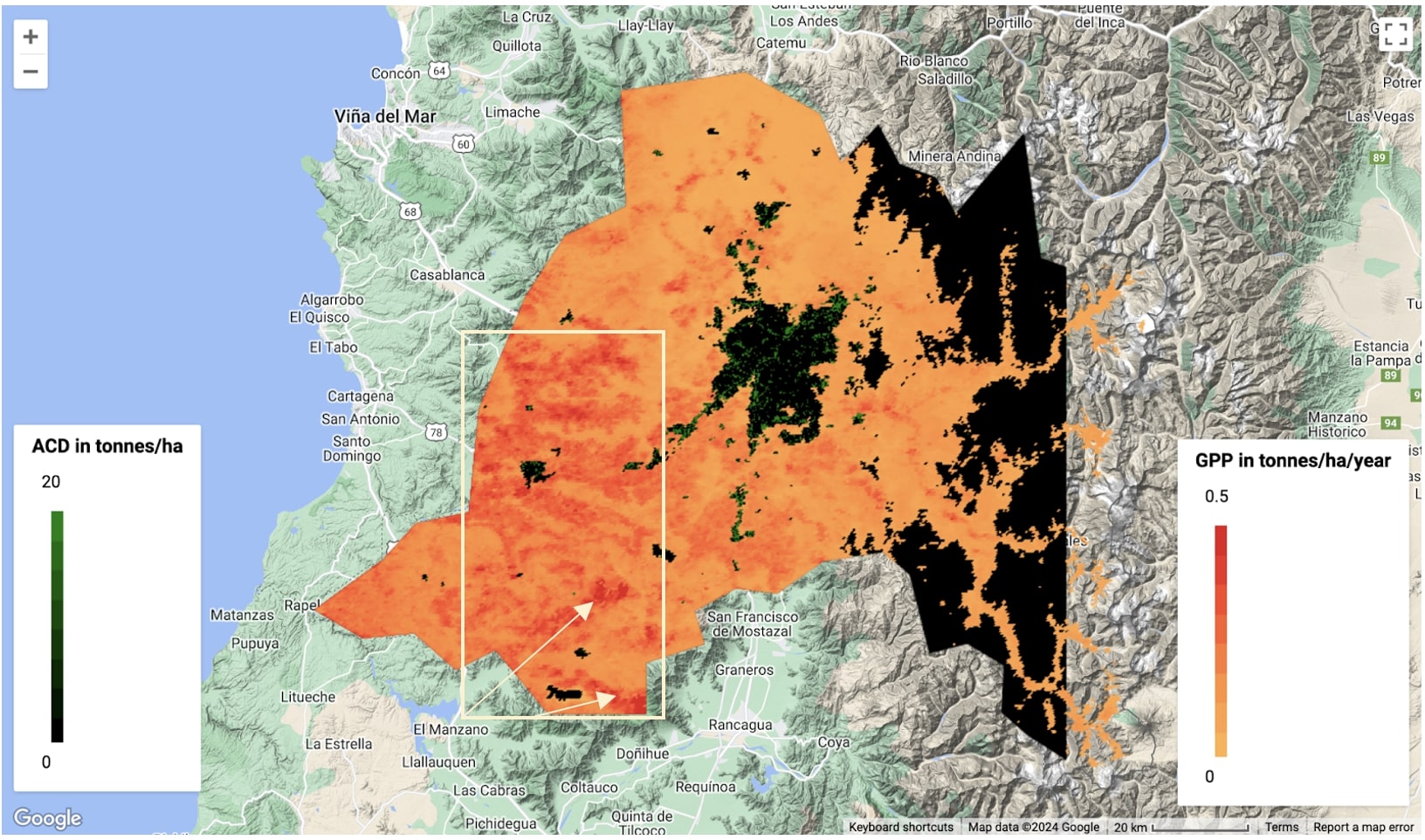
What can be seen
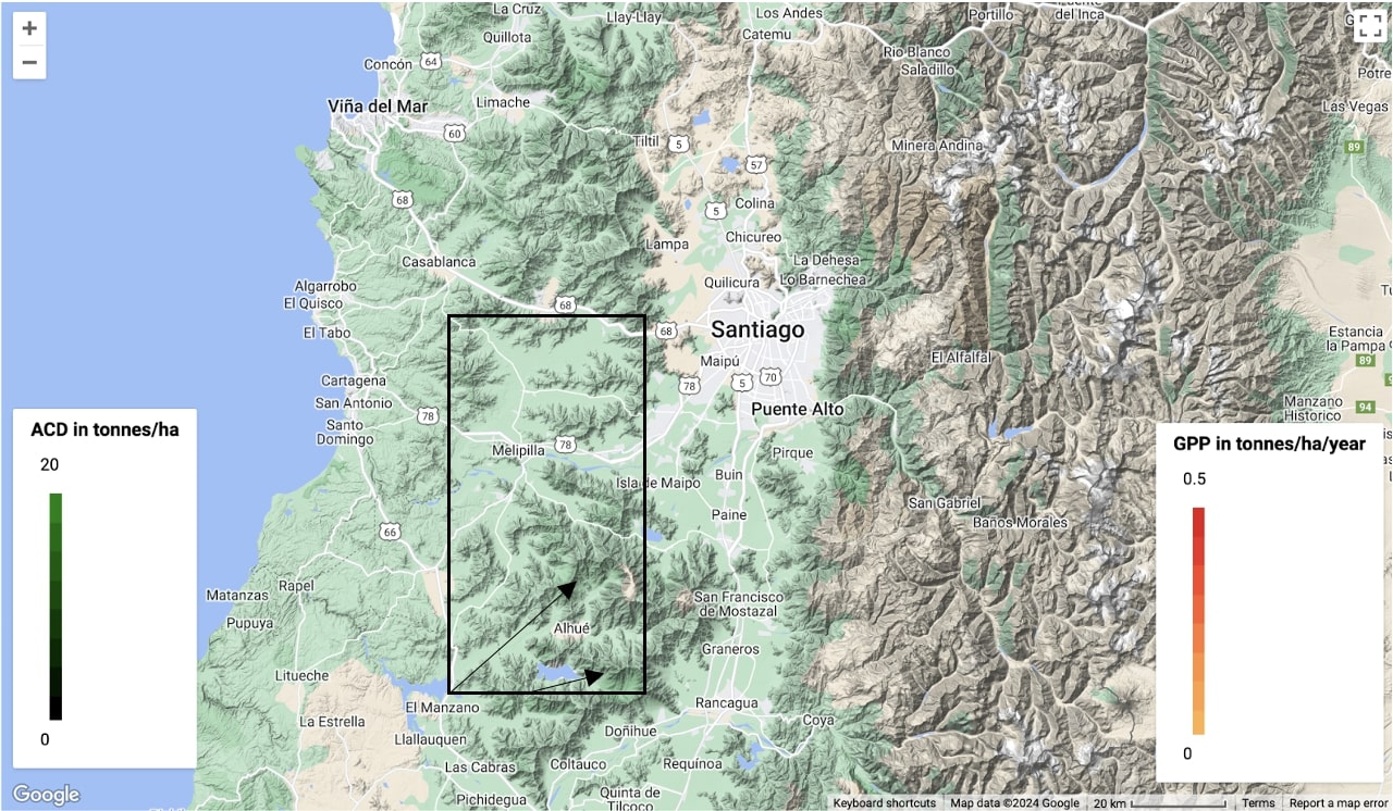
As indicated by the arrows, the south west corner of the region has the highest GPP (0.3) and AGD (150) values. Increased GPP and ACD represent a significant level of carbon assimilation and storage, indicating highly productive and carbon-rich ecosystems that could be highly effective in carbon offset efforts. Interestingly, the chosen area corresponds to an already established and well forested park called Cerro Cantillana, meaning it would be procedurally doable to convert it into a protected conservation area.
Feedback
From students and instructor.