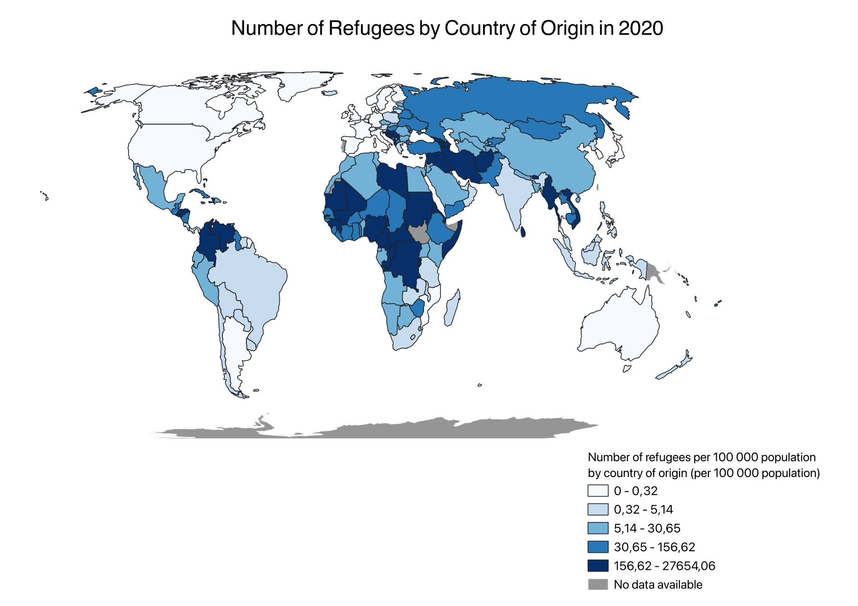
Choropleth
Choropleth map showing UN SDG indicator 10.7.4.
This portfolio is a collection of all maps I made in the University College Utrecht UCSCIEARL5 GIS course. Geographic information systems allow us to store, manage, analyze, edit, output, and visualize geographic data. The applications of GIS are endless; from urban planning to public health, environmental and disaster management, GIS is a verstile a powerful tool that enables informed decision making and management of resources.
Choropleth map showing UN SDG indicator 10.7.4.
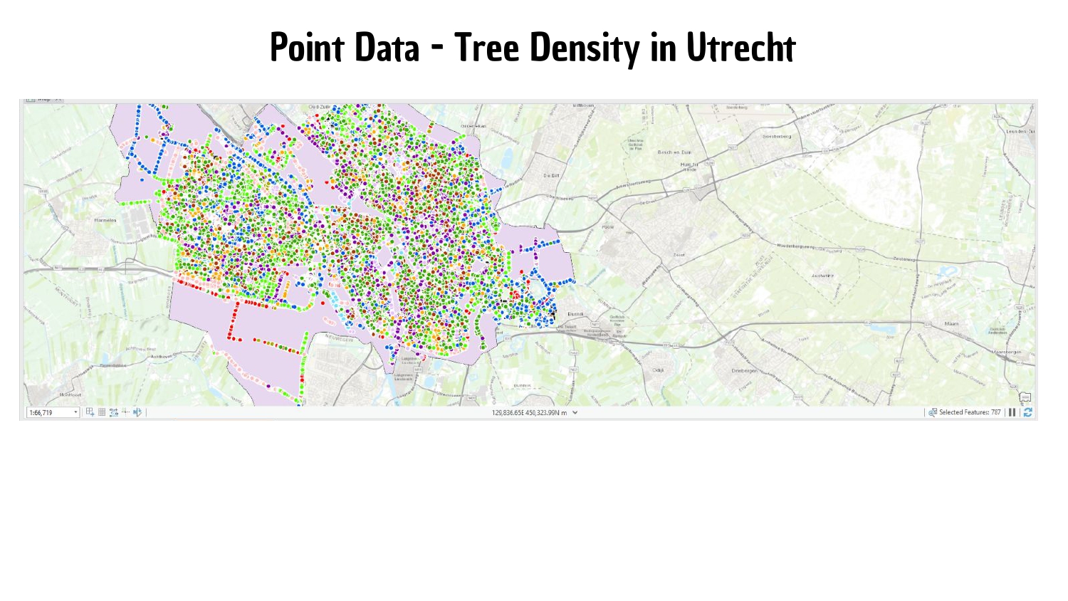
Working towards achieving SDG 15: Tree density map of Utrecht.
Land cover classification techniques in Science Park, Utrecht.
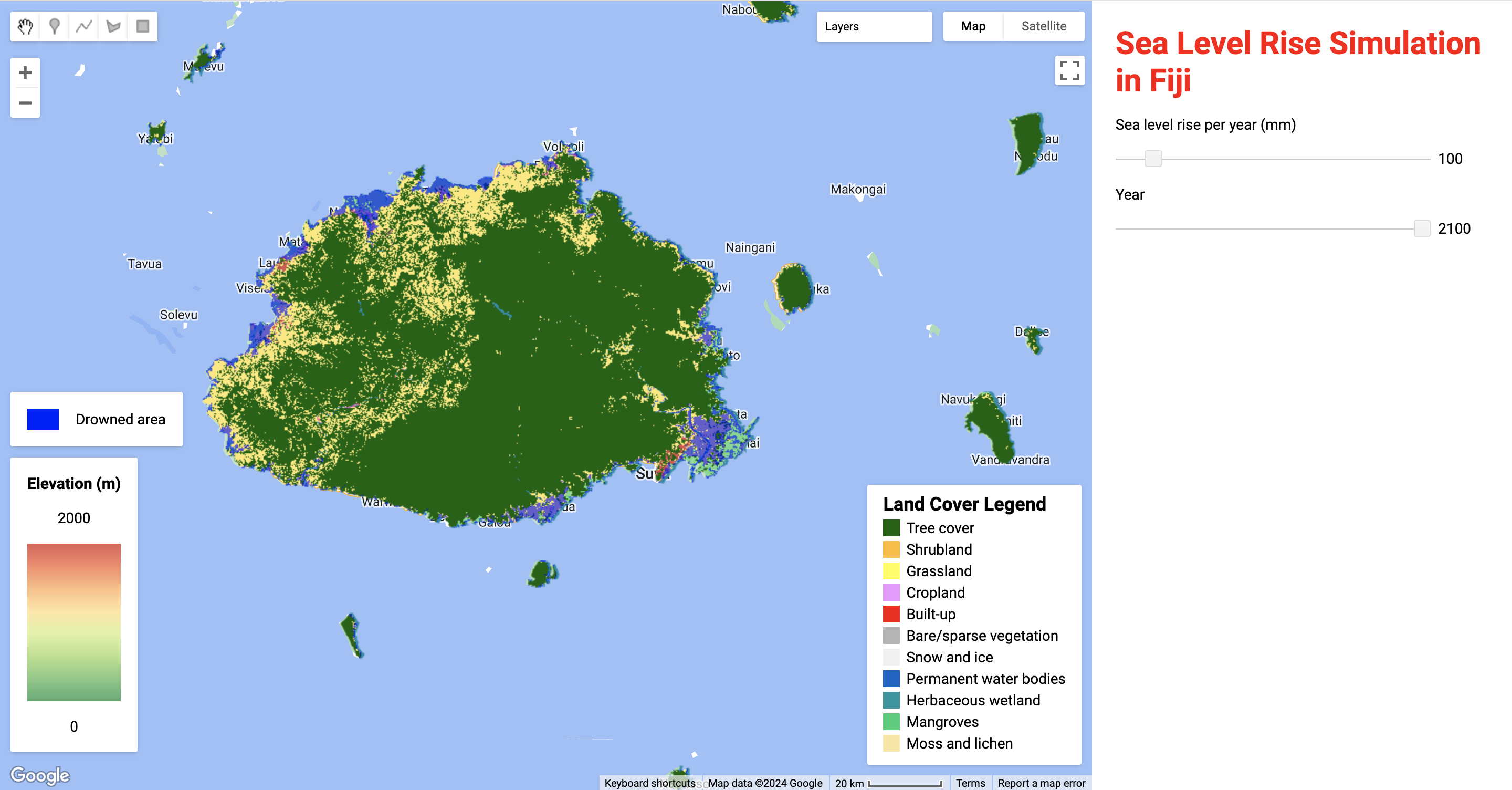
Sea level rise simulation, drown areas and land cover type in Viti Levu, Fiji.
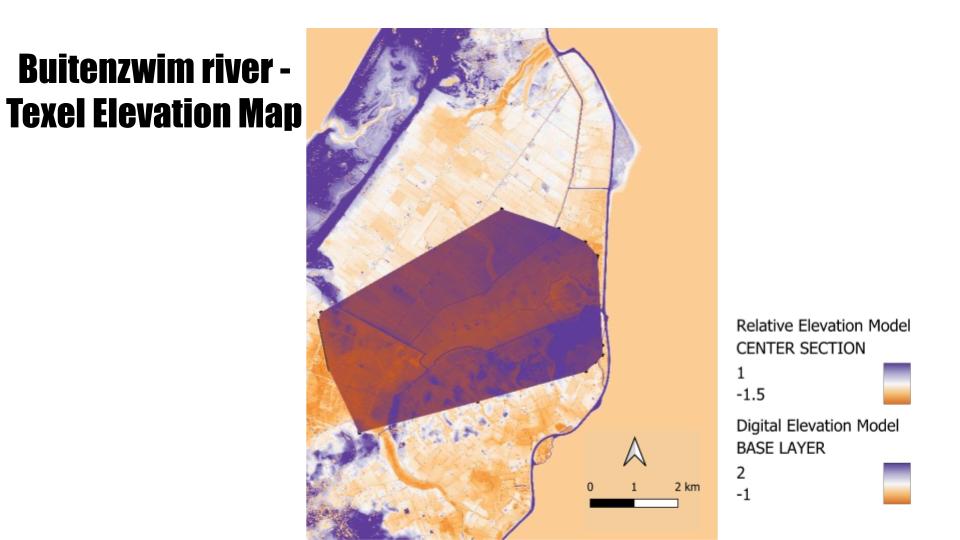
Digital Elevation Model and Relative Elevation Models of Texel Island, the Netherlands.
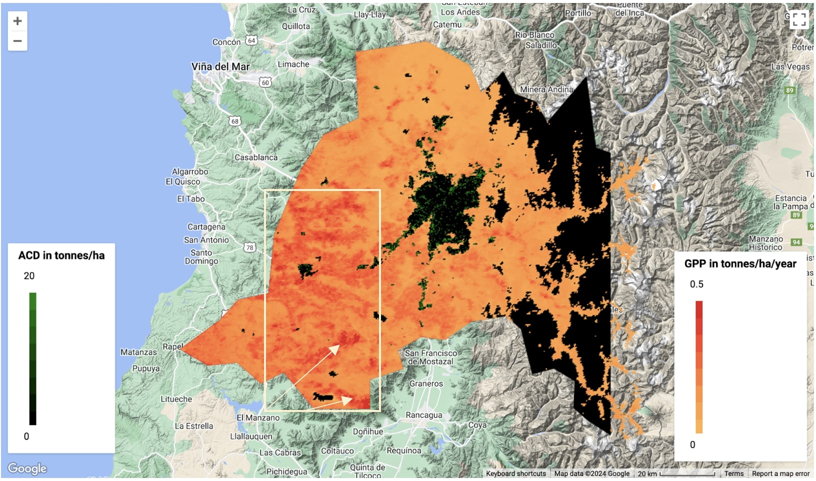
Carbon sequestration map, calculating GPP and ACD in the Santiago Metropolitan Region.